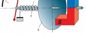
Principle of operation
The operating principle is based on tracking the coordinates of an object in space via a satellite. GLONASS uses Russian near-Earth vehicles. The data is transferred to a module installed in the tracker in the car (of any brand - be it a domestic Lada Granta or a foreign Hyundai), where it is accumulated and after some time sent to the company’s server. In the company, the dispatcher coordinates further actions.
The module in the car determines coordinates using data from at least 3 satellites. It receives information about their location, speed and time. Based on this information, one’s own coordinates are calculated.
Comparison with GPS
For clarity, the analysis of the 2 systems is presented in the table.
| Parameter for comparison | GPS | GLONASS |
| Satellites and their number | 32 American devices are used | 27 Russian satellites are used |
| Coverage area | The entire Earth, except the circumpolar regions | 2/3 of the world and all of Russia |
| Data signal | Information is transmitted via CDMA - a less secure but more accessible line | Special protected FDMA stream |
| Error in determining coordinates | 2–4 m | 3–6 m in the world and 1–2 m in Russia |
| Signal frequency | 1.575 GHz – standard and 1.227 GHz – high precision | 1.6 GHz – standard and 1.2 GHz – high precision |
| Satellite locations | At an altitude of 20 thousand km with an inclination angle of 55 degrees, they move synchronously with the planet, therefore they need correction stations (CSS) on Earth | At an altitude of 19 thousand km with an inclination angle of 64.8 degrees, they move in the opposite direction with the planet. Produces a more accurate signal that does not require additional correction |
GLONASS is better for monitoring in Russia, since it is a domestic system. Even in the wilderness, it will transmit a stable signal from satellites to trackers. GPS does not guarantee this, although it covers the entire territory of the Russian Federation.
GPS and GLONASS satellite orbits
Important! The GLONASS error in Russia is only 1–2 m. GPS cannot achieve a better result.
Scope of application
System used:
- When monitoring transport. It is possible not only to track the car using ERA-GLONASS, but also to monitor the fuel level, compliance with the driver’s work and rest schedule (whether the employee is returning or decided to deviate from the route), and speed.
- In systems that prevent theft. The trackers will send a signal to the owner if the coordinates of the vehicle begin to change. Some sensors react not only to movement, but even to starting the engine.
- In cars without pilots. GLONASS is used for navigation in such vehicles along with various sensors that assess the situation around the vehicle.
- In the on-board computers of ships and aircraft. Satellites help ships navigate difficult weather conditions without deviating from their course.
- In geodesy. The information is used to update information in the cadastre.
- In construction. Beacons are placed on expensive equipment in order to find out about its movement.
The scope of GLONASS is very wide, and only some of the most popular areas are listed above.
Vehicle control
Machine monitoring allows you to:
- Determine the location of equipment in space.
- Monitor the car and its trajectory online.
- Monitor the route and find out about deviations from it by creating geopoints on the map.
You can also find out about the fuel level and obtain information from other sensors (tachograph, tire pressure, etc.).
Driver control
Monitoring includes:
- control over the driver’s movements;
- monitoring speed limits using a car tracker;
- ensuring the safety of cargo and the driver through a panic button;
- availability of direct two-way communication with the dispatcher;
- control over the use of fuel cards.
Integration with other systems
"1C:Enterprise" allows you to install personal or automotive GLONASS monitoring. Features include:
- movement tracking;
- notification of pre-configured events;
- control of actual mileage;
- compiling reports both for an individual employee and for all full-time employees of the fleet;
- preventing deviations from the constructed route;
- receiving a signal from the SOS button;
- generating a report on gasoline consumption.
Along with trackers, various sensors are installed on cars:
- fuel;
- availability of passengers;
- opening the door;
- work of special mechanisms;
- starting the engine;
- temperature (especially useful for refrigerators to control the increase in parameter).
“1C”, together with satellite monitoring, helps you keep your finger on the pulse and quickly respond to all changes.
In addition to 1C, ERA-GLONASS plans to merge with Platon. But for now the plan is being developed. In this way, the state wants to take full control of the cargo transportation sector and track the movement of each driver, incl. monitor the disposal of solid household waste.
Is it possible to track a car using GLONASS?
The GLONASS vehicle tracking system allows you to easily determine the location of the vehicle, because this is one of its main functions. This is a special device that includes a receiver and transmitter. The first communicates with satellites and determines coordinates, and the second transmits information to a server or another device, for example, a laptop / smartphone.
Information from the tracker is available around the clock, so when you connect it to a laptop, PC or phone, you can get the car’s coordinates at any time. Some devices broadcast information constantly, but there are models that transmit data at intervals. The system's capabilities allow you to track a car via GLONASS via a phone or computer, find it and return it in case of theft.
Many questions concern the “branch” of the main system. Car owners often ask if it is possible to track a car through ERA GLONASS. The task of the system is to inform special services about an accident for the rapid arrival of ambulances and / or firefighters, depending on the situation. As in a conventional system, there is a built-in navigation model and a GSM device that allows you to track the car via a computer or in another way.
In both cases, it is possible to track the vehicle's movement via GLONASS. The difference is that in the first case this happens taking into account functional tasks and in a constant mode, and in the second - only when necessary: in case of an accident or when manually calling operators.
Remote vehicle monitoring
This is a whole complex of systems that not only tracks movement, but also allows you to:
- control some mechanisms in the vehicle;
- control the time the machine is used;
- learn about the driver’s actions (not through video surveillance and wiretapping, but using a tachograph);
- set geofences beyond which it is impossible to travel, otherwise a message will be sent to the control room.
Remote monitoring is very expensive, since it involves installing a number of sensors and the need to purchase special software.
A Brief Overview of Satellite Vehicle Tracking Technology
Modern GPS car tracking technologies are widespread today due to their effectiveness and low cost. An increasing number of such systems are used to control both personal and business vehicles. The essence of both solutions is location monitoring using GLONASS and GPS satellite navigation signals, for the purpose of which an additional unit is installed in the tracked car - a GPS satellite tracker. Due to the different requirements of individuals and organizations, GPS vehicle tracking systems are divided into two broad categories - for private or corporate use.
ERA system
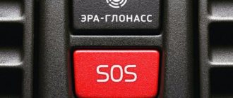
The system consists of a special device and an information platform. Simply put, it is a panic button that automatically contacts emergency services when involved in an accident. The message is carried out using cellular communications, and all towers located nearby are analyzed and the one from which the strongest signal is used is used.
ERA-GLONASS
A call can also be made manually by pressing a button. All signals from ERA-GLONASS are processed as a matter of priority. When a message is received, the emergency service checks the accuracy of the information by calling the driver back, and then goes to the scene of the accident. If a person is unconscious and unable to respond, rescuers will also respond to the call.
For information. The name "ERA" stands for "Emergency Emergency Response". It speaks for itself.
Features of work
In addition to the telephone function, ERA-GLONASS includes several sensors. They react to vehicle impacts from the sides, front and rear. Some of them record whether the driver and passengers in the cabin are fastened, others assess the severity of damage in an accident.
As soon as a car gets into an accident, the system immediately collects all the information and sends it to the emergency phone number. If the network is overloaded or busy with non-urgent calls, they are interrupted so that the SOS signal can reach the control room without interference.
Reference. In Europe there is a similar program - eCall. It sends data about the location of the car in the event of an accident.
What data does it transmit?
The system generates a kind of card into which the following data is entered:
- time of accident;
- coordinates of the incident;
- brand of transport;
- number of passengers (fastened and without seat belt);
- severity of injury;
- type of fuel used.
All this information is transmitted to the rescue post. The exact amount of information depends on the brand. For example, a KIA will have more data from sensors than a cheaper domestically produced model.
Mandatory preset
Law No. 395 of December 28, 2013 was developed, according to which all vehicles produced for use in the Customs Union will be equipped with the ERA-GLONASS system from 2021. In 2013, Lada Vesta became the first vehicle on which the panic button was experimentally tested.
ERA GLONASS
Mandatory pre-installation has led to an increase in the cost of cars, since a number of crash tests must be carried out before implementing the system. Because of this, some elite companies have completely stopped selling products in Russia.
Why do you need a car tracking system?
The main purpose of monitoring devices is to track a car at any time of the day and in any weather conditions. This applies to both private and corporate transport.
There are situations when such equipment is necessary. For example, when you need to monitor a stolen car. Because even closed paid parking lots do not provide a 100% guarantee of safety. The owner sees movement along the route, stops. The technology reduces the time it takes to search for a stolen car.
Depending on the installed functions, the device sends notifications about the position of the car, opening of doors, and unplanned movement.
Tracking equipment is widely used in transport companies, for example, in rescue services, taxi companies, car rentals, passenger and cargo transportation, and goods delivery.
The list of options is expanding significantly. In addition to the route, the manager monitors the drivers’ work schedule. Monitors technical condition: engine speed, fuel level, sensor readings. This makes it possible to control the behavior of drivers on the road and eliminate the use of vehicles and fuels and lubricants for personal purposes. As a result, reduce the cost of repairs and refueling, and the time spent on the route.
Myths about use
Drivers are wary of monitoring, thinking that it means the end of their “private life.” But the system only controls movement. Yes, you won’t be able to turn off the route, but GLONASS does not transmit information about what is happening inside the cabin. Trackers are not equipped with a microphone and speakers, they do not record conversations, and do not conduct video surveillance.
For your information. Beacons help drivers, because thanks to them it is possible to use a panic button and emergency communication with the control room.
Top manufacturers
There are criteria for choosing a company. It is important what equipment the company uses - open or closed. The first implies a further free transition to other software, since there is no strict binding of devices to any one system. With closed equipment, it is not so easy to go to another company, since all equipment is configured for a specific system.
It is important to find out what program is used for control. Before purchasing, you should inquire about its functionality, the possibility of independent modification, and the amount of equipment that can be attached to it.
Wialon
This is the leader in Russia and the CIS countries in GPS-GLONASS. The company has been on the market since 2008, and in 2021 it was the first among integrators to connect 100 thousand objects to its system.
Vialon offers both a comprehensive solution for transport monitoring and separate equipment. For an additional fee you can buy sensors and trackers with an installation service.
Login to your personal account in the Wialon system
Peculiarities
Uniqueness of Wialon:
- The program is compatible with more than 2200 types of beacons and other equipment.
- In addition to the system, the kit includes applications for monitoring transport, delivery services, driving quality, employee work hours, as well as for planning equipment maintenance.
- Monitoring can be done anywhere in the world from various devices. Information is transmitted not only via SMS, but also by email.
- The ability to modernize and refine the program to suit your needs.
In addition, users praise the 24-hour technical support.
Price
The exact amount is not indicated on the official website, since the price is determined individually, depending on the user’s needs. It is impossible to know in advance how much the complex will cost. The range is very wide - from 350 rubles/month and above. For clarification, you need to contact the company manager.
Instructions
The instructions are on the manufacturer's website. To start working with the system, install the Vialon application through the Play Market or App Store. After adding objects in the program, open the “Monitoring” tab.
A map with all vehicles will be displayed. On the left is a list of cars. Clicking on each of them will help you track your route online.
Autograph
Moscow company offering monitoring services for water and road transport. It has developed its own monitoring software and installed numerous sensors.
"Autograph"
Possibilities
The company's solution helps:
- find out where the vehicle is parked or driving;
- record your movement on the map online;
- control downtime;
- protect equipment from theft;
- control the operation of the vehicle fleet;
- find out fuel consumption.
The exact list of tasks depends on the user's needs.
Price
There is no price on the website. Order a “Call Back” to clarify the data.
How to use
You need to install the AutoGRAPH GSM program. After opening it, a work area will appear, including both a map with moving objects and a control panel with control points, lists of groups and flights. Selecting a driver will display its current position on the screen and movement.
SCOUT
The company was founded in 2005 and offers a full range of monitoring services for all types of special equipment and vehicles. There are both comprehensive control solutions with a set of sensors and programs, as well as separate equipment.
Peculiarities
With SCOUT you can:
- see the history of the movement;
- find out the current position of the vehicle and its path;
- view graphical and tabular reports;
- receive notifications about scheduled events.
The MT-700 monitoring module is installed on the vehicle. Software available for download: “Studio”, “Online” and “Kernel”. The fuel control sensor is purchased separately.
SCOUT MT-700
Reference. The company offers a demo mode that allows you to find out the capabilities of the program without paying.
Price
The cost is not indicated on the website. To find out exactly how much a comprehensive satellite monitoring kit costs, you need to fill out an application. The manager, having ascertained the needs, will provide price information.
Instructions
The Scout Studio program is used for tracking. After installation on the computer and opening it, the user immediately sees the map. It shows all the cars, and at the bottom of the panel there is information for each of them. The user sees information about location, engine operation, fuel level, address and SIM number.
Autonavix
Novosibirsk company specializing in the installation of trackers and other equipment. The company uses the Vialon program for monitoring. After concluding the agreement, a login and password are sent to enter your personal account.
Login to the Vialon system
Specifications
Thanks to the monitoring system it is possible:
- set geofences;
- take into account fuel consumption;
- generate a flexible individual report;
- create daily tasks;
- analyze vehicle management and calculate its depreciation.
Avtonaviks does not offer its own tracking platform.
What is the price
This company also does not have cost information on its website. The price is specified through the manager. There is no data even for individual equipment (tachographs, beacons, etc.).
User manual
After installing and opening the program from Avtonaviks, the user is immediately taken to the screen with the map. It needs to be updated so that all registered objects are displayed. To do this, click on the “All” button at the top of the list. Then all that remains is to select the desired car to see its movement.
Navigation systems
The Rostov company has been on the market since 2009. It deals with all types of transport - from land to water and air. It specializes in both individual supplies of equipment and installation of complex systems for monitoring the operation of an enterprise.
Peculiarities
. It allows you to control:
- travel history;
- vehicle downtime;
- fuel consumption and drainage;
- going beyond established geofences;
- sensor readings;
- gas station and parking places;
- compliance with speed limits and routes.
Price
There are 3 tariffs, each with different costs:
- Economy Terminal – from 3,000 rubles, annual fee is also 3,000 rubles.
- Standard. Terminal – from 8,000 rubles, annual price – 3,850 rubles.
- Premium Terminal – from 18,000 rubles, per year – from 30,000 rubles.
The subscription fee includes a different set of services, the exact list of which is clarified with the company manager.
Instructions
To control your movement, you need to download and install the Sirius Navigator program on your computer, then log into your personal account and add objects to the software. Then you should select: “View” - “Maps”. Information about the terrain and vehicles will appear. Clicking on each of the objects will allow you to see the vehicle’s movements.
Reference. The “Reports” tab will help you find out the history of movements for a specific time interval, for example, a month.
The process of tracking cars using GLONASS
Car owners often worry before purchasing a tracker: if they can determine the coordinates of a vehicle, will someone else be able to do it. However, access to information by third parties is excluded, unless you provide someone with your own gadget or PC to control the car. If you choose a domestic satellite positioning system, it connects to a hack-proof nationwide network.
To determine the coordinates of an object, you only need a tracker, but the specifics of the device and its configuration affect the capabilities. For example, some models provide an emergency alert when an object leaves a safe zone. This feature is in demand among parents who want to protect their children: they can specify the route from school and back, and if they try to take the child off the permitted streets, a message will be sent to the phone of one of the parents.
However, emergency notification is also in demand by commercial enterprises, but they use it differently. The manager issues tasks to traveling employees, determines the optimal route and permissible deviations from it. If an employee wants to leave the permitted area for personal business, the dispatcher will receive an alert.
Satellite positioning helps solve the following problems:
- creation of automated transport control programs;
- determination of vehicle coordinates in real time;
- control of additional parameters: speed, fuel consumption;
- searching for a car after theft, when investigating crimes.
The technology guarantees the protection of personal data, so individuals and organizations do not have to worry about information leakage. Information about vehicles is available only to owners; in exceptional cases, they may be requested by law enforcement agencies.
Is it possible to cheat
Many drivers, knowing that the operation of the satellite is influenced by various factors (weather, magnetic storms, etc.), try to create interference on their own and thereby disable the monitoring. To deceive GLONASS, it is often used:
- Power off. The easiest way to bypass the operation of the device, however, information about loss of signal is immediately transmitted to the control room.
- Removing the SIM card. The information will not be sent, but it will be saved in the tracker's internal memory. As soon as the SIM is returned to its place, the information will immediately be sent to the control room.
- Use of special “jammers”. Many modern monitoring systems are equipped with anti-lock devices. They will immediately detect an attempt to deceive and send the data to the company.
- Mechanical failure of the tracker. The company's engineers will subsequently be able to identify the cause of the malfunction, and the deception will be revealed.
- Reconfiguring the device. Not everyone can do this; in addition, there is a high probability that the beacon will stop working.
Transport monitoring services using GLONASS are gaining popularity. They are used by fleet owners, businessmen involved in cargo transportation, and taxi drivers. Integration into other systems is possible to expand functionality.
Why do you need car tracking?
The objectives for performing such work vary from system to system. For example, it is unlikely that you will be able to find a car online using the standard ERA GLONASS, because it is “tailored” for transmitting information to emergency services. The exception is situations when police are involved in the search.
In general, the ability to track a car using GLONASS via a computer/laptop or phone provides many opportunities. Let's highlight the main ones:
- Monitor vehicle location online from your phone or PC. As a result, you can easily find the place where your car is parked. Location and speed are calculated using GLONASS and GPS satellites with maximum accuracy. In underground parking lots/garages there is additional geolocation that allows you to navigate using GSM signals.
- Car protection. Unlike ERA GLONASS, which does not perform a search if it is stolen, a special system allows you to quickly determine the location of the car via a computer or phone. Information also comes when loading onto a tow truck, or if an unauthorized person gets into the cabin. Active protection is provided by blocking the engine start using an electronic key or via a remote command from the application.
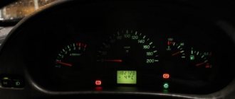
- Technical condition monitoring. When the malfunction lamp lights up, the system provides the necessary data to the computer/phone, which allows you to draw conclusions about the breakdown of any unit. Some systems monitor the mileage of the car and promptly remind you of the need to carry out scheduled maintenance and change your MTPL policy.
- Caring for relatives. Knowing how to find a car using GLONASS through your phone or computer, you can quickly find your loved ones and come to their aid. If a loved one is driving, you can control the speed, driving habits or location.